“I keep hearing about accidents on Mount Rinjani. Is it safe to climb right now?” “Is the volcano erupting?” “When is the trail closed?” These are the questions we hear most from people on Lombok who are deciding whether to climb Mount Rinjani (Gunung Rinjani, 3,726 m).
The short answer: several falls and slips were reported in 2025 and 2026, and in August 2025 the climbing rules were tightened in response. The volcano is at the second of four alert levels, with an exclusion zone around the crater. The trails can also be shut by the rainy-season closure, wildfires and other events.
So before you climb, check four things in order: the volcano’s alert level, whether the trail is open, whether you are going through a licensed operator and guide, and the weather and how you feel on the day. If any of them is not met, the realistic choice is to change your dates or skip the summit.
This article is based only on information we could read in full: Indonesian and international news reports, Indonesia’s Geological Agency, and the Smithsonian Institution’s Global Volcanism Program database. We could not find official statistics on the total number of accidents, and we could not open the latest page of the official volcano monitoring site (MAGMA Indonesia), so the alert level is given as reported in September 2026.
It is written for travellers heading to Lombok, often via Bali, who are deciding whether to fit a Rinjani trek into their trip. The basics of the climb (routes, number of days, costs) are covered in our Mount Rinjani trekking guide; this article sticks to safety and the latest situation.
As of October 2026
What this article covers
- ✓The main accidents reported on Mount Rinjani in 2025 and 2026
- ✓The climbing rules added after the accidents (the SOP in force since August 2025)
- ✓The eruption history of the Barujari crater and the current alert level
- ✓The 2026 closure and reopening, and the September wildfire closure
- ✓What to check before you climb, in what order, and what you can do to lower the risk
In short
In June 2025 a Brazilian woman fell to her death on the summit route of Mount Rinjani, and with more injuries before and after, all routes were closed for 10 days in August 2025 while the safety procedures (SOP) were revised. As reported in September 2026, the volcano is at Level II (Waspada, alert), and entry within 1.5 km of the Barujari crater is prohibited. In 2026 the mountain reopened on 1 April after the January to March closure, but from 1 September new bookings on eRinjani were stopped as a wildfire precaution, and a wildfire in late September closed the Torean route. The Senaru route reopened on 3 October and five routes are running, but we could not confirm as of 9 October that the Torean route has reopened. Before you climb, check the volcano’s alert level, whether the trail is open, your licensed operator and guide, and the weather and how you feel on the day.
What accidents have happened on Mount Rinjani recently?
The table below lists the main accidents we could confirm in news reports since 2025. Most happened on the way to the summit, on the descent from the summit, or on the trail down to the crater lake, Segara Anak. Besides falls, there were injuries from slips and a death after a climber collapsed during the ascent.
← Scroll the table sideways
| When | Where (as reported) | What happened |
|---|---|---|
| Early May 2025 | Trail near Banyu Urip (on the descent) | A Malaysian climber let go of a safety rope, slipped and fell about 80 m into a ravine. Rescuers recovered him the next day and confirmed his death |
| 21 June 2025 | Summit route on the Sembalun side, near Cemara Nunggal (about 2,800 m) | A Brazilian woman fell about 600 m down a steep slope. Fog and bad weather slowed the rescue; rescuers reached her on the 24th and confirmed her death, and she was brought up on the 25th |
| 29 June 2025 | Exact location not given in reports | A Malaysian climber was injured |
| 16 July 2025 | Trail from the Sembalun gate towards Lake Segara Anak | A Swiss climber slipped on the trail, suffering a fracture and bleeding |
| 17 July 2025 | Exact location not given in reports | A Dutch climber was injured |
| 14 May 2026 | Sembalun route | A climber from West Java lost consciousness on the way up and died after being evacuated (the cause could not be confirmed in reports) |
| 25 May 2026 | Descent from the summit towards Sembalun | A Malaysian climber suffered a serious spinal injury. Thick fog delayed the helicopter, and he was flown to a hospital in Bali the next morning |
| 14 September 2026 | Trail between Senaru and Batu Ceper | A Chinese woman hit her head hard and lost consciousness. Rescuers reached her at about 20:00 the same day and carried her in relays to the Senaru post |
Based on reports by ANTARA, detikBali, The Sun (Malaysia), TTG Asia, MerahPutih, iNews, Metro TV, Disway and others. As of October 2026. This is not a complete list of all accidents.
The death of the Brazilian woman in June 2025 was widely reported in Indonesia and abroad. The rescue helicopter on standby could not fly because of the weather, and on the steep slope in thick fog it took rescuers about three days from the report that she was missing to reach her. During the rescue, the national park (TNGR) closed only the summit route for a time and kept the trail open as far as the lake and the crater-rim camp at Plawangan.
After the accident, Indonesia’s Ministry of Tourism urged travellers to use only licensed operators and certified guides for high-risk activities such as climbing.
As for the number of accidents, ANTARA (Yogyakarta edition) reported in June 2025 that there had been “more than ten” climbing accidents on Mount Rinjani in the past five years, but we could not find annual statistics published by the national park or others. The cases listed here are only some of those reported.
How did the climbing rules change after the accidents?
After a run of injuries from late June into July 2025, the trail from Plawangan Sembalun to Lake Segara Anak was closed on 18 July, and from 1 to 10 August all six routes were closed: Senaru, Torean, Sembalun, Timbanuh, Tetebatu and Aik Berik. The mountain reopened on 11 August, and the main procedures (SOP) set out by the national park at that time were as follows.
Main procedures from 11 August 2025 (as reported by detikBali)
- ✓Book your entry ticket online through the eRinjani app
- ✓Bring a health certificate issued the day before you start climbing
- ✓Enter your insurance details and sign a consent form (informed consent)
- ✓Attend a safety briefing before setting off
- ✓One certified guide may take no more than five climbers; one porter no more than two foreign climbers
- ✓For the summit, an extra guide is recommended (not compulsory)
- ✓Operators must provide tents, a first-aid kit, rope of at least 10 m and other equipment
Foreign climbers must go through a trekking organiser to climb Mount Rinjani. ANTARA reported that in October 2024 four foreigners who tried to climb from the Sembalun side without an operator were stopped by national park staff and fined. In June 2026 the head of the national park again urged climbers not to climb alone (at least two people per group) and to climb with a guide or an experienced climber.
It has also been reported that, with the 2026 reopening, climbers are fitted with RFID wristbands or personal trackers so that a command centre can follow their position. We could not confirm details of how this works on the ground, such as whether everyone actually receives one.
Is the volcano erupting now? (The Barujari crater and the alert level)
Eruptions at Mount Rinjani happen at Barujari (Gunung Barujari), a small volcano inside the crater lake Segara Anak within the caldera. According to an ANTARA report on 21 September 2026, the regional volcano monitoring office (Balai PGMBG Nusa Tenggara) said Mount Rinjani is at Level II (Waspada, alert) and asked climbers and nearby residents not to enter within 1.5 km of the centre of the Barujari crater. Indonesia’s alert system has four levels, and Level II is the second from the bottom.
The most recent eruptions in the Smithsonian Institution’s database are in 2015 and 2016. In the eruption from late October to late December 2015, the ash column reached about 6 km above sea level and lava flowed into the lake. In November 2015, as the eruption continued, airports including Bali’s Ngurah Rai were reported to have closed for a time.
In the eruption of 27 September 2016, the ash column rose about 2,000 m above the summit (about 6,000 m above sea level), and the alert level was raised from Level I to Level II. Activities and camping inside the caldera and within 3 km of the Barujari crater were banned, and 389 people (333 of them foreigners) who had entered from the Sembalun side were reported to be on the mountain at the time.
The Geological Agency also explains that if an eruption raises the lake level, flash floods could occur along the Kokok Putih river to the north. The official source of volcano information is the agency’s Centre for Volcanology and Geological Hazard Mitigation (PVMBG), and the agency asks people to check eruption information against official announcements. PVMBG information is also published on MAGMA Indonesia, but we could not open MAGMA Indonesia when writing this article, so check the latest level yourself before you climb.
Apart from the volcano, earthquakes are also a factor. In the Lombok earthquake of 29 July 2018, landslides on the mountain led to the evacuation of 543 climbers, guides and porters, and one person was killed by falling debris. Earthquakes on Lombok in general are covered in our Lombok earthquake and tsunami guide.
When is the trail closed? (The rainy-season closure and the 2026 wildfire)
Every year Mount Rinjani closes all routes at the height of the rainy season. In 2025 it was closed from 1 January to 2 April, and in 2026 from 1 January to 31 March, reopening on 1 April. The reasons given are the risk of heavy rain, strong winds and landslides, and giving the ecosystem a rest. Bookings for 2026 opened on eRinjani on 6 March. The closure dates change slightly from year to year, so check each year’s announcement.
The trails can also close at the end of the dry season. On 1 September 2026, following a circular from the Ministry of Forestry, the mountain moved to a “limited opening” to prevent wildfires, and new bookings on eRinjani were stopped (bookings paid before then were said to remain valid). Then, on the evening of 22 September, a wildfire broke out near Bukit Setampol on the Torean side, and the Torean route was closed from the 23rd. The national park put the burned area at about 1,098 hectares as of 27 September (a provisional estimate).
According to the national park’s announcement of 3 October (reported by Katadata and by The Star on 6 October), the Senaru route, which had been closed temporarily because of the fire, reopened on 3 October, and five routes are running: Sembalun, Senaru, Timbanuh, Tetebatu and Aik Berik. The Torean route is not among them, and we could not confirm as of 9 October 2026 that it has reopened.
On bookings, the same announcement says that “online registration is available on eRinjani”. However, we could not find an announcement that explicitly says the new bookings stopped on 1 September have formally resumed. Check which dates you can book directly with eRinjani and your operator.
Figure: How the Mount Rinjani trails changed in 2026
What should you check before you climb, and in what order?
Putting all of the above in the order to check before you set off gives the figure below. Work from the top, and if the answer is “no” at any point, the safe choice is to change your dates or skip the summit and do a different route.
Figure: Deciding whether to climb Mount Rinjani
What can travellers do to lower the risk?
Build spare days into your plans. In 2025 routes were shut suddenly in July and August, and in 2026 in September, in the middle of the dry season, because of accidents and wildfires. With one or two days of slack before and after Rinjani, a closure or bad weather is less likely to affect your flight home.
Keep not going to the summit as an option. Most of the reported accidents happened on the summit route and on the way down from the summit. Some Rinjani treks turn back at Plawangan on the crater rim, and during the June 2025 rescue only the summit route was closed while the crater rim and the lake stayed open. If you are unsure about your fitness or the weather, choosing a trek without the summit from the start is one option.
Take extra care on the way down. The accidents in May 2025 and May 2026 both happened during the descent. On slippery sections, keep hold of ropes and handrails, and do not drift away from your guide when you are tired.
Read your insurance conditions before you go. In the May 2026 accident, the injured climber was flown by helicopter to a hospital in Bali. Check that your policy covers search and rescue costs and medical evacuation, and that trekking is covered at all.
Some travel insurers, for example, list “mountaineering” that uses ice axes, crampons or ropes as a hazardous activity (one example is the declaration terms of AIG’s travel insurance in Japan). The surest way to find out how a Rinjani trek is treated is to ask your insurer. For hospitals and insurance in general, see our guide to hospitals, medical care and travel insurance on Lombok.
Note
- Rescue takes time: In the June 2025 accident, rescuers took about three days to arrive, and in the September 2026 accident about 12 hours passed between the accident and the rescuers reaching the climber. Helicopters cannot fly in fog.
- Avoid unlicensed operators and climbing alone: Foreign climbers must go through an operator, and breaking this rule can lead to a fine.
If there is an accident on the mountain, how does the rescue work?
According to news reports, rescues on Mount Rinjani are carried out jointly by the Mataram office of the National Search and Rescue Agency (Basarnas), the national park, the police, the military and others. The September 2026 accident happened at about 8:00 in the morning, and the rescuers arrived at about 20:15 that night. From there she was carried by hand in relays to the post on the Senaru side. In the May 2026 accident, thick fog delayed the helicopter; it took off from Sembalun after 8:00 the next morning and flew via the heliport in Benoa, Bali, to a hospital in Sanur.
In other words, if you are hurt high on the mountain, you may not reach a hospital quickly. Before you climb, ask your operator whether the guide carries a radio or other means of communication and a first-aid kit, and where the plan is to descend in an emergency. Knowing this in advance speeds things up if something goes wrong.
A note from Sekotong
News of Rinjani closures and reopenings often appears first in Indonesian-language media, and it takes time for information in other languages to catch up. A few days before you set off, ask your operator whether the route is open and whether your eRinjani booking is confirmed, and keep their answer in writing. It also helps to tell the places you stay before and after the climb when you expect to come down, so they can reach you if plans change.
The downsides of Mount Rinjani and Lombok, and who they suit
To be honest, Mount Rinjani is not a mountain you can count on climbing just because you turn up. It is an active volcano with an exclusion zone, it closes in the rainy season, and even in the dry season routes can shut suddenly because of accidents or wildfires. If you have an accident high on the mountain, rescue and evacuation can take anything from half a day to several days. It does not suit you if standing on the summit on a fixed date is your top priority, or if your trip is too short to allow spare days.
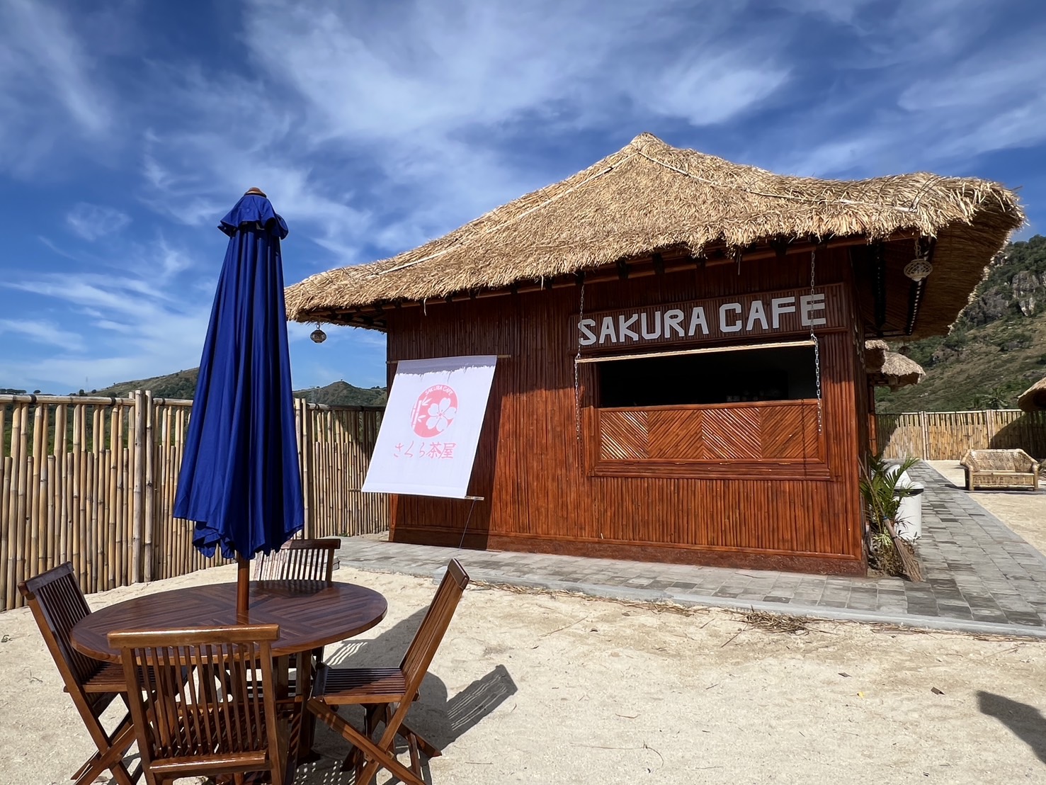
On the other hand, if you choose a licensed operator, keep spare days, and are willing to skip the summit depending on the weather and how you feel, it can be a major reason for a trip to Lombok. As a place to rest before or after the climb, there is also Sekotong in the southwest of the island. In a fishing village in Sekotong, we run a beach cafe (SAKURA CAFE) and a market with local Sasak people, and offer a stay programme that includes airport transfers and getting around during your stay.
Frequently asked questions
Q. Is Mount Rinjani erupting now?
According to a report on 21 September 2026, the alert level is Level II (Waspada, alert), and entry within 1.5 km of the centre of the Barujari crater is prohibited. The most recent eruptions were in 2015 and 2016. Check the latest situation in announcements by PVMBG and MAGMA Indonesia.
Q. Where did the Brazilian woman’s accident in June 2025 happen?
According to reports, she fell about 600 m down a steep slope near Cemara Nunggal (about 2,800 m) on the summit route from the Sembalun side. Fog and bad weather made the rescue difficult, and she had died by the time rescuers reached her.
Q. Can I climb without a guide?
Foreign climbers must go through a trekking organiser, and there are reports of foreigners being fined for trying to climb without one. Under the procedures in force since August 2025, one certified guide may take no more than five climbers.
Q. When is the mountain closed?
All routes close at the height of the rainy season: from 1 January to 2 April in 2025, and from 1 January to 31 March in 2026. Routes can also close temporarily in the dry season because of accidents or wildfires; in September 2026 the Torean route was closed by a wildfire.
Q. Where do I book?
You need to book online through the national park’s eRinjani app, and foreign climbers must go through a trekking organiser. New bookings were stopped on 1 September 2026 as a wildfire precaution. The national park’s announcement of 3 October says online registration is available on eRinjani, but as of 9 October we had not found an announcement that explicitly says new bookings have formally resumed.
Summary
On Mount Rinjani, a series of falls and slips on the summit route and on the way down were reported in 2025 and 2026, and in August 2025 all routes were closed while the procedures (SOP) were revised. As of September 2026 the volcano is at Level II, with no entry within 1.5 km of the Barujari crater. As of October 2026 five routes are running, and the reopening of the Torean route, closed by a wildfire, has not been confirmed.
Before you climb, check the volcano’s alert level, whether the trail is open, your licensed operator and guide, and the weather and how you feel on the day, in that order. Keep spare days, and keep skipping the summit as an option. The situation changes from month to month, so check the latest information from the national park and your operator just before you leave.
Related reading
- Mount Rinjani trekking guideRoutes, itineraries, permits and typical costs
- Hospitals, medical care and travel insurance on LombokHospitals if you are injured, transfers to Bali, and how to think about insurance
- Earthquakes and tsunamis on LombokWhat travellers should know and prepare for since the 2018 earthquake
SEMELAR BEACH VILLAGE
Come and spend some time in the Sekotong village we call home
About 1 hour 10 minutes by car from Lombok International Airport. We offer a stay programme of 3 nights/4 days or more, with island trips by local boat and sunsets at SAKURA CAFE. The villas are due to be completed in stages from 2027.
Sources for this article
- RRI, “SAR Team Recovers Body of Brazilian Climber on Mount Rinjani” (June 2025)https://rri.co.id/en/national/1606777/sar-team-recovers-body-of-brazilian-climber-on-mount-rinjani
- ANTARA Jogja, “Duka dari Gunung Rinjani di Juni 2025” (27 June 2025)https://jogja.antaranews.com/berita/751349/duka-dari-gunung-rinjani-di-juni-2025
- detikBali, temporary closure of the summit route (24 June 2025)https://www.detik.com/bali/nusra/d-7980821/pendakian-rinjani-ditutup-gegara-turis-brasil-jatuh-wisatawan-gagal-naik
- The Sun (Malaysia), fall of a Malaysian climber (5 May 2025)https://thesun.my/malaysia-news/search-team-recovers-body-of-malaysian-who-fell-on-rinjani-trail-kg14036480/
- The Sun (Malaysia), appeal by the tourism minister (28 June 2025)https://thesun.my/world-news/indonesia-urges-safer-hiking-after-tourist-death-on-mount-rinjani-hb14371350/
- MerahPutih, injury of a Swiss climber (16 July 2025)https://www.merahputih.com/post/read/jatuh-di-rinjani-pendaki-swiss-patah-tulang-dan-pendarahan-kepala
- TTG Asia, “Indonesia shuts Mount Rinjani routes to review climber safety protocols” (30 July 2025)https://www.ttgasia.com/2025/07/30/indonesia-shuts-mount-rinjani-routes-to-review-climber-safety-protocols/
- MerahPutih, closure of all routes from 1 to 10 August 2025 (24 July 2025)https://www.merahputih.com/post/read/semua-jalur-rinjani-ditutup-total-1-10-agustus-ada-6-ini-nama-treknya
- detikBali, reopening on 11 August and the new SOP (9 August 2025)https://www.detik.com/bali/wisata/d-8053403/pendakian-gunung-rinjani-kembali-dibuka-11-agustus-tngr-ingatkan-sop-baru
- Indonesian National Police (INP), “Mount Rinjani reopens Monday after safety overhaul” (11 August 2025)https://inp.polri.go.id/artikel/mount-rinjani-reopens-monday-after-safety-overhaul
- ANTARA, foreigners stopped from climbing without an operator (1 November 2024)https://megapolitan.antaranews.com/berita/318185/petugas-tngr-ntb-tindak-tegas-empat-wna-mendaki-secara-ilegal-melalui-jalur-sembalun-tanpa-izin
- Metro TV, “Ini Aturan Ketat Pendakian Gunung Rinjani” (12 June 2026)https://www.metrotvnews.com/read/KvJCJjWa-ini-aturan-ketat-pendakian-gunung-rinjani
- MerahPutih, closure from 1 January to 2 April 2025 (21 December 2024)https://www.merahputih.com/post/read/seluruh-jalur-pendakian-gunung-rinjani-akan-ditutup-1-januari-2-april-2025
- detikBali, all routes closed until April 2026 (20 December 2025)https://www.detik.com/bali/nusra/d-8269419/semua-jalur-pendakian-gunung-rinjani-resmi-ditutup-hingga-april-2026
- ANTARA, reopening on 1 April 2026 (3 March 2026)https://megapolitan.antaranews.com/berita/507266/pendakian-gunung-rinjani-di-ntb-dibuka-1-april-2026
- Koran Jakarta, 2026 bookings open from 6 March (5 March 2026)https://koran-jakarta.com/2026-03-05/booking-tiket-online-pendakian-rinjani-2026-dibuka-besok-6-maret-cek-cara-pesan-di-sini
- ANTARA English, “Rinjani reopens climbing activities on limited basis” (1 September 2026)https://en.antaranews.com/news/429324/rinjanireopens-climbing-activities-on-limited-basis
- Katadata, Torean route closed by wildfire (25 September 2026)https://katadata.co.id/ekonomi-hijau/ekonomi-sirkular/6ab5e54e2fc46/589-hektare-lahan-gunung-rinjani-terbakar-jalur-pendakian-torean-ditutup
- journalarta, burned area of about 1,098 hectares (28 September 2026)https://journalarta.com/news/2026/09/28/kebakaran-di-gunung-rinjani-capai-1-098-hektare/
- Katadata, five routes running again (3 October 2026)https://katadata.co.id/berita/nasional/6ac073578f7e1/lima-jalur-pendakian-gunung-rinjani-kembali-dibuka-simak-rutenya
- The Star (Malaysia), “Mt Rinjani’s hiking route reopened after blaze” (6 October 2026)https://www.thestar.com.my/aseanplus/aseanplus-news/2026/10/06/mt-rinjanis-hiking-route-reopened-after-blaze
- ANTARA, Mount Rinjani at Level II (Waspada) (21 September 2026)https://www.antaranews.com/berita/5751116/pgmbg-gunung-rinjani-berstatus-waspada-sejak-2015
- Ministry of Energy and Mineral Resources, eruption of Mount Rinjani on 27 September 2016https://esdm.go.id/id/media-center/arsip-berita/letusan-gunungapi-rinjani-27-september-2016-pukul-1445-wita
- Ministry of Energy and Mineral Resources, raising of Mount Rinjani’s alert level and recommendations (September 2016)https://esdm.go.id/id/media-center/arsip-berita/mulai-tanggal-27-september-2016-pukul-1500-wita-status-g-rinjani-waspada
- Ministry of Energy and Mineral Resources, PVMBG as the official source of volcanic activity information (September 2016)https://esdm.go.id/id/media-center/arsip-berita/pvmbg-sumber-resmi-aktivitas-gunungapi-di-indonesia
- Smithsonian Global Volcanism Program, “Rinjani”https://volcano.si.edu/volcano.cfm?vn=264030
- ANTARA, Mount Rinjani remains at Level II, airport closure (4 November 2015)https://gorontalo.antaranews.com/berita/18879/status-gunung-rinjani-masih-waspada-bandara-ngurah-rai-ditutup-sampai-kamis
- Bisnis.com, Barujari eruption with 389 people on the mountain (28 September 2016)https://kabar24.bisnis.com/read/20160928/78/587533/gunung-barujari-meletus-389-wisatawan-terjebak
- Tempo English, “Lombok Earthquake, 543 Mt. Rinjani Hikers Successfully Evacuated” (31 July 2018)https://en.tempo.co/read/920390/lombok-earthquake-543-mt-rinjani-hikers-successfully-evacuated
- Metro TV, death of a climber from West Java (24 May 2026)https://www.metrotvnews.com/play/bJECjw3Y-pendaki-asal-jabar-meninggal-di-rinjani-hingga-wni-ditangkap-israel-sepekan-mtvn
- RCTI+ (iNews), helicopter evacuation of a Malaysian climber (26 May 2026)https://www.rctiplus.com/news/detail/nasional/5391781/wna-malaysia-jatuh-di-gunung-rinjani–tim-sar-kerahkan-helikopter
- Disway, rescue of a Chinese climber (15 September 2026)https://disway.id/read/968624/pendaki-wna-tiongkok-terpeleset-di-rinjani-tim-sar-bergerak-evakuasi
- AIG Japan, travel insurance declaration terms (definition of mountaineering; in Japanese)https://travel.aig.co.jp/content/dam/tg-japan/ctr/dta/pc/pdf/dta_declaration.pdf